Hawaii Tsunamis

Hawaiian Tsunami History and Facts
The Big Island of Hawaii is home to Kilauea, the world’s most active volcano. This volcanically active island is no stranger to tsunamis. The Big Island’s university town of Hilo has sustained numerous long range tsunamis, yet oddly enough only two tsunamis, in 1868 and 1975, were generated locally by the Big Island’s active volcanoes.
On April 2, 1868, an earthquake with a magnitude estimated between 7.25 and 7.9 (on the Richter scale), rocked the southeast coast of Hawaii. This was the most destructive, volcanically generated earthquake in the recorded history of Hawaii. It triggered a landslide on Mauna Loa, five miles north of Pahala, killing 31 people. The resulting tsunami claimed 46 lives and damaged several villages on the southern coast. The tsunami rolled over the tops of the coconut trees up to 60 feet high, and it reached inland, up to a quarter of a mile in some coastal regions.
In the 1920s, Thomas Jaggar, the volcanologist and founder of Kilauea’s Jagger Observatory, was the first to predict a locally generated tsunami. His prediction was not taken seriously. That event was not destructive and only one Hawaiian fisherman died.
The city of Hilo, located near the slopes of the Kilauea Volcano, has sustained the worst damage in Hawaii from long-range, generated tsunamis. The most destructive tsunamis to hit Hawaii came from thousands of miles away, traveling over vast, deep stretches of the Pacific.
The first was in 1946, which struck without warning. It was generated from an earthquake in the Aleutian Islands. Hilo’s north facing bay and offshore underwater canyons channeled the waves’ intensity and focused them directly into town. Estimated to be over fifty feet, the tsunami waves took the lives of 159 people, including twenty-five students and staff at a sea-level school north of Hilo on the Hamakua Coast. Calculated in today’s dollars, the tsunami destruction caused $300,000,000 in damages.
Fourteen years later, after Hilo was rebuilt, another tsunami struck. This one was generated by an earthquake in Chile. Even though the residents were forewarned, some refused to leave. There had been prior warnings (in 1952 and 1957) that produced small tsunamis with little damage and some people were not concerned.
The first small waves struck and reached only three feet high. So residents that had evacuated earlier came back to the tsunami zone. But then, subsequent waves exceeding 35 feet hit the town and 65 people perished in the disaster. In today’s dollars, the property destruction totaled $125,000,000. That same tsunami continued on to Japan, where it hit with such force that over 200 people died. Since then a large portion of the Hilo Bayfront land has been designated to grassy parks and is a no build zone.
On November 29, 1975, a 37-mile-wide section of the Hilina Slump (a chunk of the south slope of the Kilauea Volcano that is slipping away), dropped twelve feet and slid toward the ocean. This movement caused a 7.2 magnitude earthquake and a resulting 48-foot-high tsunami. Once again on the southern coast, the tsunami destroyed oceanfront property, washing homes off their foundations. Two deaths were reported and 19 people were injured.
Presently across the State of Hawaii, there are advanced warnings for tsunamis. Tsunami evacuation signs are placed along most Hawaiian coastal routes, advising the public how to get to higher ground. On the first workday of every month, the Pacific Tsunami Warning Center (PTWC) tests its loud sounding warning sirens. PTWC is an early warning system that was first established in 1949 after the ‘46 tsunami devastated Hilo without warning.
With an area of 4,028 square miles and a population of 185,000, the Big Island of Hawaii has 63% of the Hawaiian archipelago’s combined landmass. All three other main Hawaiian Islands could fit inside of the Big Island. It is the third largest island in Polynesia, just behind the two main islands of New Zealand.
Scientists monitor the possibility of large, locally generated earthquakes on the Big Island’s southeast coast resulting from volcanic disturbance or eruption. If this happens, a sizable tsunami could occur, flaring out and wrapping around the Hawaiian Islands with little or no warning time. The resulting infraction, or wrapping tsunami waves, could reach Hilo and Kona within 5-10 minutes, Maui in about 20 minutes, Oahu in 30 minutes, and Kauai within an hour.
The Big Island is so massive and volcanically active, that it could break apart into several smaller islands, causing a major catastrophic event. The story you have just read are fictional but could happen…
Acknowledgments: The Korean Survivors of No Gun Ri Massacre, U.S. Korean War Veterans. William Britt for his creative cover design and help, C.J. Kale for his cover photos and images on Lava Light Galleries.com. Chuck Blay, Hawaii Geologist, for his scientific advice, U.S. Army ex-Special Forces, Tony Colgrove, our military adviser. Wikipedia Commons, Katherine Von Pelt, Editor. Our copy editors – Matthew Toffolo, Dan Patching, and Julie Foss, who helped us with the manuscript.
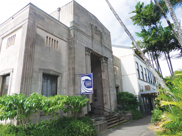
For more interesting Tsunami info check out Pacific Tsunami Museum — http://tsunami.org/


